Metizoft provides a turnkey solution for Inventory of Hazardous Materials (IHM) for the maritime industry. The IHM monitors hazardous materials on board a ship.

Managing hazardous materials on board vessels in operation and during recycling at the end of a ship’s life is a major challenge.

The new IHM Convention requires registration of all hazardous components and materials used in the construction of a ship and its equipment. Each subsequent owner of the ship is required to record any changes in materials or equipment throughout the ship’s life cycle. The IHM report must be delivered to the recycling facility when the ship is sent for scrapping or recycling.

IHM for optimal safety

Metizoft offers a certified IHM system that is in line with regulations such as the International Maritime Organization’s (IMO) Hong Kong Convention for the Safe and Environmentally Sound Recycling of Ships and the EU Ship Recycling Regulation. The IHM system can handle the documentation process for the ship’s entire life cycle, monitoring more than 20 types of hazardous materials, including asbestos, PCBs and CFCs.

A real-time updated IHM helps the ship’s crew to manage hazardous materials by taking the necessary safety precautions. For example, if a significant amount of asbestos is found on board a vessel, Metizoft creates an asbestos management plan.

The IHM also makes it is easy to create a recycling plan with focus on worker safety. By knowing beforehand where hazardous materials are located, ship recycling workers can avoid exposure to these harmful substances.

Concrete benefits

Metizoft’s solution can be used for all types of vessels and maritime constructions that fall under the IHM Convention.

As a HazMat Expert company with certified IHM inspectors, Metizoft can handle the IHM for both new and existing vessels. An existing vessel without an IHM is required to have an inspection performed by certified personnel. Inspectors enter the ship to take samples to check for hazardous materials. These are then sent to a certified laboratory. The inspection and lab results are documented in an IHM report. Once the IHM report is approved, Metizoft can assist in keeping the IHM up to date.

Metizoft and its subsidiaries are certified by DNV GL, ABS, Lloyd’s Register and BV.

IHM inspection onboard a vessel.

IHM inspection onboard a vessel.

Metizoft AS

Market potential

By the end of 2020, approximately 30 000 ships worldwide will be required to have a real-time updated IHM on board to avoid violation of the EU Ship Recycling Regulation. It is estimated that approximately 60 000 vessels worldwide will be affected by the IMO’s Hong Kong Convention.

IHM software. Once a vessel has an IHM, regulations require a system and a designated person that will keep the IHM up to date throughout the ship’s life cycle.

theexplorer


DUBLINAug. 18, 2020 /PRNewswire/ — The “Maritime Satellite Communication Market by Component (Solutions and Services), Solution (VSAT and MSS), Service (Tracking and Monitoring, Voice, Video, Data), End User (Merchant Shipping, Offshore, Government), and Region – Global Forecast to 2025” report has been added to ResearchAndMarkets.com’s offering.

The global maritime satellite communication market is expected to reach USD 3,251 million by 2025, growing at a Compound Annual Growth Rate (CAGR) of 7.1% during the forecast period.

The escalating need for enriched data communication to improve operation efficiency, on-board security, and surveillance, and employee/passenger welfare in the maritime industry is driving the market. Furthermore, The major factor driving the maritime satellite communication market is the need to attain improved connectivity between the land and sea operations and realizing benefits in faster repair times, preventative maintenance, fuel-saving, and real-time navigation.

Solutions segment to lead the maritime satellite communication market in 2020

As more and more commercial and government mariners are moving toward deploying satellite-based communication services, absolute communication technology is required. Solutions comprise two types of marine satellite communication VSAT and MSS. The players in the maritime satellite communication market are moving from MSS towards VSAT to offer clients with affordable communication services and increased bandwidth. Modernizing ship management systems to improve engine and systems maintenance, navigation, weather information, and cargo tracking is gaining momentum in maritime VSATapplications.

Merchant shipping segment among end-user to lead the maritime satellite communication market in 2020

Merchant shipping is mainly used for carrying passengers or cargo for commercial purposes. Owing to the necessity to operate ships efficiently, enhance overall business operation, and ensure crew loyalty and satisfaction, the crew owners are increasingly deploying maritime satellite communication systems. In recent years, satellite communication technology has become advanced, which enables ships to communicate through satellite links from anywhere globally without the help of a specialist radio officer. This technological advancement helps merchants gain higher profit through reliable communication services that maintain operational efficiency.

APAC to lead the maritime satellite communication market in 2020

The maritime satellite communication market in APAC is the largest in terms of market size and is highly fragmented based on multi-currencies and multi-languages. The region comprises a diverse range of countries, from economically and technologically advanced countries, such as the UK and Germany, to severely debt-ridden countries, such as Greece and Austria. The UK, PolandSpain, and Germany are the leading countries in the European maritime satellite communication market. The total contactless spending has grown in these countries with the increasing circulation of contactless cards and terminals by card companies, such as Visa and Mastercard.

Research Coverage

The report segments the global maritime satellite communication market by component(solutions and services), Very Small Aperture Terminal (VSAT), end-user, and region. The report includes an in-depth competitive analysis of key players in the maritime satellite communication market, along with their company profiles, recent developments, and key market strategies.

Major vendors in the global maritime satellite communication market include Inmarsat (UK), Iridium Communications (US), Thuraya (UAEHughes Network Systems (US), KVH Industries (US), Viasat (US), Speedcast (Australia), ST Engineering (Singapore), NSSLGlobal (England), Marlink (France), ORBOCOMM (US), Navarino (Greece), Network Innovations (Canada), GTMaritime (England), AST Group (UK), Isotropic Networks (Wisconsin), Norsat International (Ontario), Satcom Global (Canada), Intelsat (US), and Orbit Communication Systems (Israel).

Key Topics Covered

1 Introduction
1.1 Introduction to COVID-19
1.2 COVID-19 Health Assessment
1.3 COVID-19 Economic Assessment
1.4 Objectives of the Study
1.5 Market Definition
1.6 Market Scope
1.7 Currency Considered
1.8 Stakeholders

2 Research Methodology

3 Executive Summary

4 Premium Insights
4.1 Attractive Opportunities in the Maritime Satellite Communication Market
4.2 Market, by Component and Region
4.3 Market, by Region
4.4 Market: Investment Scenario

5 Market Overview and Industry Trends
5.1 Market Dynamics
5.1.1 Drivers
5.1.1.1 New Satellite Systems and Data-Intensive Applications to Drive the Growth of the Market
5.1.1.2 Increased Technology Advancements and Less Expensive Technology Solutions
5.1.1.3 Growth in Bandwidth Requirements and Communication Needs
5.1.2 Restraints
5.1.2.1 Lack of Awareness About Advanced Maritime Satellite Services
5.1.2.2 Reliance on High-Cost Satellite Equipment
5.1.3 Opportunities
5.1.3.1 Increasing Demand for Broadband Connections and VSAT Connectivity
5.1.3.2 High-Throughput Satellites to Unlock Cloud and IoT Services
5.1.3.3 Unification of Satellites and Cellular Communication Technology
5.1.4 Challenges
5.1.4.1 Increasing Cybersecurity Attacks
5.1.4.2 Lack of Reliability and Flexibility of Satellite Communication
5.1.4.3 Coping Up With Rapidly Changing Technologies
5.2 Industry Use Cases
5.2.1 Use Case 1: Inmarsat Global Xpress Helped Eukor Car Carriers for Its Fleet of 27 Vessels
5.2.2 Use Case 2: Thuraya Helped Devor Technologies to Bring Reliable, High-Speed Internet Connection to Offshore Maritime Operator
5.2.3 Use Case 3: Viasat Helped M/Y Starfire in Delivering High-Speed Connectivity to Support Luxury Guest Experience
5.2.4 Use Case 4: NSSLGlobal Helped MOL LNG by Providing Reliable Services for Managing Fleet of 15 LNG Carriers
5.3 Impact of Disruptive Technologies
5.3.1 Internet of Things
5.3.2 5G

6 COVID-19 Impact on Maritime Satellite Communication Market

7 Maritime Satellite Communication Market, by Component
7.1 Introduction
7.2 Solutions

8 Maritime Satellite Communication Market, by Solution
8.1 Introduction
8.2 Very Small Aperture Terminal
8.3 Mobile Satellite Services

9 Maritime Satellite Communication Market, by Service
9.1 Introduction
9.2 Tracking and Monitoring
9.3 Voice
9.4 Video
9.5 Data

10 Maritime Satellite Communication Market, by End-user
10.1 Introduction
10.2 Merchant Shipping
10.3 Fishing
10.4 Passenger Ships
10.5 Leisure Vessel
10.6 Offshore
10.7 Government
10.8 Others

11 Maritime Satellite Communication Market, by Region
11.1 Introduction
11.2 North America
11.3 Europe
11.4 Asia-Pacific
11.5 Middle East and Africa
11.6 Latin America

12 Competitive Landscape
12.1 Introduction
12.2 Competitive Leadership Mapping
12.2.1 Visionary Leaders
12.2.2 Dynamic Differentiators
12.2.3 Innovators
12.2.4 Emerging Companies
12.3 Strength of Product Portfolio
12.4 Business Strategy Excellence
12.5 Ranking of Key Players

13 Company Profiles
13.1 Introduction
13.2 Inmarsat
13.3 Iridium Communications
13.4 Thuraya
13.5 Hughes Network Systems
13.6 KHV Industries
13.7 Viasat
13.8 Speedcast
13.9 ST Engineering
13.10 NSSLGlobal
13.11 Marlink
13.12 Orbcomm
13.13 Navarino
13.14 Network Innovations
13.15 GTMaritime
13.16 AST Group
13.17 Isotropic Networks
13.18 Norsat International
13.19 Satcom Global
13.20 Intelsat
13.21 Orbit Communication Systems
13.22 Right-To-Win

For more information about this report visit https://www.researchandmarkets.com/r/7o30de


DUBLINAug. 17, 2020 /PRNewswire/ — ResearchAndMarkets.com published a new article on the electric boat industry “Electric Boats 2020: Technological Improvements in Lithium Ion Batteries are Changing Maritime Industry Attitudes”

The maritime industry has traditionally viewed electric boats as impractical. This is due mainly to concerns that an electric motor would not be able to supply the increased amount of power needed to move a boat versus a car as well as fears that electric boats would not have the range to cover long distances. However, these attitudes are beginning to change with improvements in lithium ion battery technology along with an increased focus on sustainable alternatives to fossil fuels.

Yamaha recently launched a trial of its new HARMO system on the Otaru Canal in Hokkaido, Japan. HARMO integrates a twin electric boat motor with a next generation steering control system. Yamaha hopes to bring the HARMO system to the European market which is affected by increasing restrictions on the use of fossil fuel powered crafts on inland waterways. A Seattle based startup Zin Boats is also looking to prove that electric boats can be a practical and sustainable alternative to traditional boats. The Z2T and Z2R models use an all carbon fiber construction making them half the weight of a comparable craft while the BMW batteries offer a fast recharge and an 100 mile average range.

To see the full article and a list of related reports on the market, visit “Electric Boats 2020: Technological Improvements in Lithium Ion Batteries are Changing Maritime Industry Attitudes”

About ResearchAndMarkets.com
ResearchAndMarkets.com is the world’s leading source for international market research reports and market data. We provide you with the latest data on international and regional markets, key industries, the top companies, new products and the latest trends.

SOURCE Research and Markets


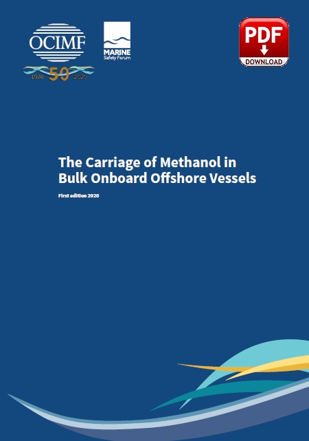
The carriage of methanol in bulk is becoming common in the offshore oil and gas industry, and although there is technical documentation on methanol handling, guidance for offshore carriage by sea is limited. This best practice document provides a guide for the safe loading, carriage and discharge of methanol by offshore support vessels.

The supply of bulk methanol to offshore locations is the responsibility of several stakeholders, including the supplier, transporter and user of the product.

Methanol (Methyl Alcohol, CH3OH) is a wood alcohol used in oil and gas production to prevent hydrate formation, which often occurs in gas condensate fields. Injection of methanol into the well downhole zone of gas hydrate fields not only causes decomposition of gas hydrates in that downhole zone of the well but also improves downhole zone filtration characteristics.

Methanol is a hazardous chemical with significant toxic, flammable, and reactive properties that can adversely affect human health and the environment when not properly handled.

Methanol is highly flammable, burns with no visible flame in daylight conditions and is readily miscible in water. Special care should be exercised when loading and discharging this product, and instructions within a vessel’s procedures or marine operation manuals should be followed.

Safety is the biggest consideration when carrying methanol in bulk.

To achieve safe carriage, all bulk methanol cargo should be maintained in an inert condition
while onboard offshore support vessels. This should be in line with the IMO OSV Chemical Code which requires an oxygen content of 8% or less and clear areas around pressure/vacuum relief valves (P/V valves) and manifolds.

The assigned product tanks should be protected by cofferdams which should be inerted by
means of water or nitrogen.

Click on below image to download the complete Guidance document:

OCIMF methanol guide

Source: OCIMF


Synergy Group and D.S. NORDEN have formed a new joint venture to handle the technical management of NORDEN’s owned tanker vessels effective as of today.

Norden Synergy Ship Management (NSSM) is a 50/50 joint venture between NORDEN and Synergy and will be headed by Henrik Christensen who previously managed NORDEN’s Technical Department.

“NORDEN is a quality, historic and renowned shipping brand with an organisation that truly lives up to its motto ‘Smarter Global Trade’,” said Captain Rajesh Unni, CEO & Founder of Synergy Group.

“We see great alignment when we have partnered previously and we expect that to lead to more mutual wins in the future through NSSM.”

The formation of NSSM further cements the partnership between Synergy Group, one of the world’s leading ship managers with a fleet of over 300 vessels, and NORDEN, the globally renowned independent shipping company founded in 1871 and listed on the Nasdaq Copenhagen exchange.

Last year, NORDEN appointed Synergy Group to manage its fleet of owned bulk carriers, with management services provided from Synergy’s head office in Singapore and its technical office in Chennai, India.

NSSM will manage NORDEN’s current fleet of Medium Range (MR) and handysize product carriers from its headquarters in Copenhagen, Denmark, with additional technical support provided by a 100%-owned subsidiary based in India.

Seafarers currently employed directly by NORDEN will be transferred to the joint venture where they will continue their employment on NORDEN-owned vessels under the same terms and conditions as before. All other seafarers will be offered new contracts through Synergy.

“Both teams are conscious about opportunities to make a difference in the industry,” added Captain Unni. “Culturally the teams have much in common and that to me is the key to this partnership.

“The joint venture will also take advantage of Synergy’s new generation digital ship offering – SMARTShip, an Internet of Things platform that enables improvement of vessel and fleet efficiency by bringing cutting edge computing to the high seas.”

Mr Christensen said he expected NSSM to benefit from Synergy Group’s longstanding reputation for excellence in all areas of shipmanagement. “Synergy has shown time and again that it is uniquely equipped to take on the most demanding technical and commercial shipmanagement challenges while also embracing the progressive core values of NORDEN on issues such as gender diversification, crew welfare and sustainability,” he said.

“Both organisations are fully aligned on these core values and in our shared view that digitalisation, smart shipping and the deployment of cutting-edge technology are critical to the successful management of vessels in the modern age.

“Together as NSSM, we will be able to deliver the full range of technical, crewing, training and technological service excellence required by NORDEN.”

Source: shipmanagementinternational


The Commission has adopted a proposal for the fishing opportunities for 2021 in the Mediterranean and the Black Seas. With the proposed fishing quota for certain fish stock, the Commission is thus delivering on the political commitments made in the ‘MedFish4ever’ and the Sofia Declarations to promote sustainable management of fish stocks in the Mediterranean and the Black Seas.

The proposal implements the multiannual management plan for demersal stocks in the Western Mediterranean, by continuing the political commitment to further reduce the fishing effort in the area of up to 40% in five years (2020-2024). It also includes notably measures for eel, red coral, dolphinfish, small pelagic species and demersal stocks in the Adriatic, deep water red shrimps stocks in the Ionian Sea, Levant Sea and the Strait of Sicily, in line with the decisions of the General Fisheries Commission for the Mediterranean (GFCM).

In the Black Sea, catch limits and quotas are proposed for turbot and sprat. For turbot, the proposal will transpose the EU quota decided in the context of the revision of the GFCM turbot multiannual management plan. For sprat, the Commission proposes to maintain the same catch limit as in 2020. The member states are expected to decide on the proposal at the November Agriculture and Fisheries Council and the quota are to be applied as of 1 January 2021.

More information is available here


Weathernews Inc. and NAVTOR have come together on a mission to enable enhanced simplicity, safety, and efficiency for forward-thinking shipowners and operators worldwide. The newly launched DOSCA DX / NavStation 5.3 marks the start of a voyage into the future of a smarter, more sustainable shipping industry.

Bjørn Åge Hjøllo, e-Navigation Manager at NAVTOR, the global leader in maritime e-Navigation, is explaining the thinking behind the collaboration with Weathernews Inc. (WNI), the world’s largest private weather service company, and the launch of a joint product that combines their expertise on a single platform.

“Simplicity is the key,” he states and WNI Executive Officer Hidenori Iwasa follows: “If we can simplify tasks we can help shipowners and operators unlock efficiencies, improve safety (with less potential for human error and non-compliance), save money, and deliver better environmental performance. By digitizing and, where possible, automating processes we can achieve this. And by working with leading partners like WNI we can integrate further expertise and user-relevant services, adding huge value.“ DOSCA DX /NavStation 5.3 is the epitome of that drive.”

Powerful partnership
WNI and NAVTOR started working together in 2018. While NAVTOR serves a global fleet of around 6,000 customers with advanced e-Navigation products and services, WNI provides weather data and route optimization solutions to around 10,000 vessels globally. The attraction, it seems, was instant:
“For collaborations to work each partner has to bring something distinct to the table, something the other party (or parties) can leverage and develop through their own specialisms,” notes NAVTOR CEO Tor Svanes.
“In this case the synergy was clear – we could combine our navigational expertise with their leadership in weather to deliver compelling benefits; helping customers achieve competitive advantage. It was an excellent foundation to begin building on.”

NavStation and Captain DOSCA are the cornerstones of that foundation.

Integrating excellence
NAVTOR launched NavStation in 2014 as the world’s first digital chart table. This unique software platform collects all the information navigators need for optimal decision making and passage planning in one place, at their fingertips.

The latest ENCs sit at the core of the solution, with further data (such as Admiralty Digital Publications (ADP), Admiralty Electronic Nautical Publications (AENP), NavArea warnings, Environmental Regulations, security alerts, regulatory information, vessel traffic, and much more) ‘layered’ over the charts for complete operational awareness.

In the WNI corner, Captain DOSCA debuted to the maritime market over a decade ago and has gone on to build a position as a globally renowned system for Optimal Weather Routing, helping customers enhance safety, save fuel, reduce emissions and cut OPEX.

By working together the two parties have combined their individual offerings, integrating an updated version of Captain DOSCA into the established NavStation platform. The result is the freshly unveiled DOSCA DX, as it will be marketed to WNI customers, or NavStation 5.3, for NAVTOR users.

But this isn’t about branding, it’s about benefits. And plenty of them.

Optimum benefits
Captain DOSCA’s success was, in part, driven by WNI’s Optimum Ship Routing (OSR) Service, whereby users feed planned routes to an onshore function that optimizes them in accordance with the very latest, detailed and trusted weather data. This allows vessels to sail safe, efficient, and economical routes.

At the same time, NavStation has surged in popularity in recent years due to its Passage Planning (PP) module, which helps automate an otherwise significant administrative burden for single vessels and entire fleets. The PP module cuts the average admin time per voyage, per vessel from over three hours to around just 30 minutes.

By combining those functionalities (amongst many others) onto a single platform, vessels now have a greatly streamlined process with one comprehensive planning station. There is no longer any need to plan on one system and optimize routes on another, transferring data and (with USB sticks as the standard bridge between computers) introducing cybersecurity risk. Everything is integrated, streamlined, and efficient.

Connecting to quality
Both partners agree that the benefits of using just one system, regarding cost and time efficiencies, are huge, but it’s the combined functionality and user-friendliness that are probably the real selling points. DOSCA DX and NavStation 5.3 take the navigators from berth to berth, with no need to piece together routes and collect data from different sources, in one seamless procedure. There’s less room for human errors, one clear process for meeting operational and environmental objectives (saving fuel, costs, and emissions), enhanced quality control, and better security and compliance.

What’s more, having OSR within NavStation’s and NAVTOR’s connected e-Navigation ecosystem allows for greater data sharing between vessels, fleets, and onshore management teams. This means companies can now monitor optimum routes, assess fuel savings, and implement improvements business-wide based on greater data insight.

“It is connected, it is efficient, it is smart.”

Future focus
And that is a critical point for WNI as NAVTOR’s partner. They see smarter data empowered services as the key to unlocking more sustainable shipping for its customer base – maximizing performance while minimizing environmental impact. Hidenori Iwasa says both firms share this vision, as well as the desire to serve their respective (and now combined) customer bases with quality solutions that meet operational needs.
DOSCA DX is the embodiment of that ambition.

“We are so excited to finally reveal our new onboard weather and routing solution”, Iwasa comments. “The launch of DOSCA DX, integrated into the new NavStation 5.3, is the first step we are taking with NAVTOR towards complete synergic e-Navigation solutions to help optimize safety, efficiency, and, most importantly, to support our customers with the need for greener shipping.”

He continues: “Without question, DOSCA DX is our most important development to date; a state-of-the-art​ solution tool, combining WNI’s high-quality weather data and best-in-class ship routing visualization and optimization with NAVTOR’s leading e-navigation solutions in a seamless user experience”.“This will help our users meet challenges and achieve business objectives – today, tomorrow, and far into the future. It is, we believe, a game-changing innovation.”

The road ahead
DOSCA DX and NavStation 5.3 launch this month – a culmination of successful collaboration, but only the first step on a greater journey.
“We have developed an excellent mutual understanding and, as respective leaders in our fields, can offer unparalleled experience and expertise to share with one another,” Hjøllo concludes. “That will help us drive new developments and continually improve the service and products we can offer to the world fleet, delivering ever greater advantages.

“Because that’s what smart shipping is really about – finding innovative solutions that provide business and environmental benefits, impacting positively upon all industry stakeholders.”
And that, at the end of the day, sounds like an optimal route forward into the future for everyone…

Source: maritimeprofessionals


The Commonwealth has issued an Invitation to Register (ITR) to industry for the Project SEA 129 Phase 5 Block 1Maritime Unmanned Aircraft Systems (MUAS) Continuous Development Program requirement for the RAN.

The ITR was issued on August 6, a day after Defence Minister Senator Linda Reynolds issued a statement announcing an “up to $1.3 billion in a new Unmanned Aircraft Systems (UAS) development program to enhance situational awareness across Australia’s vast maritime environment”. Curiously, the minister’s statement that didn’t actually mention the project’s name or designation.

The ITR covers Block 1 of the project which will see seven maritime UAS ‘capability bricks’ acquired, and will focus on “workforce growth, training system development, Combat Management System (CMS) integration, and payload development”. Block 1 systems will be operated primarily from the forthcoming Arafura class offshore patrol vessels (OPV) as well as Navy’s ANZAC class frigates (FFH), and service entry is scheduled for 2024.

The ITR says Defence’s intent is for Block 1 to be a “whole-of-systems solution provided by a single supplier”, although it will consider two suppliers to separate OPV operations from the ANZAC class if necessary.

“Whilst Defence’s strong preference is for a ‘one-size-fits-all’ solution, the differences between the OPV and MFU (major force unit) facilities, available aviation spaces, effects and operating conditions may result in the capability being delivered by two different solutions,” the ITR reads.

Although not covered in the ITR, it did lay out the program’s follow-on phases. Block 2 is scheduled to enter service in 2029 and will see a refresh of the OPV’s MUAS capability, and acquire an additional five capability bricks for other major surface assets such as the Hunter class frigates. At that time, it is anticipated that Defence will also engage a commercial capability partner “to build a mature mission and support system”.

Block 3 is scheduled to enter service from 2034 and will comprise a comprehensive update and refresh of the UAS capability’s 12 capability bricks, training, and support systems.

“Now, more than ever, Defence requires an agile acquisition strategy to take advantage of state-of-the-art technology,” the minister’s statement reads. “This acquisition heralds a new intelligence, surveillance, reconnaissance and targeting capability for Defence to ensure Australia keeps pace in this rapidly developing technology domain.

“Developing sovereign industrial capability through projects like this is critical to enhancing Australia’s industrial base and maritime security,” it adds. “This program will provide opportunities for Australian industry to innovate, develop and grow. An (ITR) will be released for industry to investigate the capability and capacity of Australian industry to deliver all elements of the Maritime UAS, including air vehicles, sensor payloads, integration, training, and sustainment.”

The Block 1 ITR is scheduled to close at 1200 on September 25, and a shortlist of contenders will be announced on December 17. An industry brief is scheduled to be conducted at 1100 on August 21.

This article was published by ADBR on August 6, 2020.


Will the safeguard of the oceans pass through space? According to a 2009 report from the International Maritime Organization (IMO), 640,000 tonnes of nets, lines, life jackets or ropes are lost or abandoned at sea by the fishing industry each year. Added to the rejected waste, these “ phantom equipment »Represent 10% of plastic pollution in the oceans. Faced with this growing phenomenon, which is damaging the seabed and costing various fishermen dearly, a company based in Toulouse, Collecte localization satellites (CLS), has just launched an experiment with the Var department’s fisheries committee.

Thanks to its know-how in the field of satellites – since its inception it has managed data collections for the Argos localization system – this subsidiary of the National Center for Space Studies (CNES), 750 employees, 50 fisheries monitoring centers and 15,000 active satellite beacons, is already involved in the sustainable management of fisheries, environmental surveillance and fleet monitoring.

Article reserved for our subscribersRead also Plastic pollution could be reduced by 80% by adopting ambitious measures

“We have been doing research and development on this new system for two years, says Gaëtan Fabritius, director of the company’s “innovation and prospective” department. Knowing the position of their equipment, fishermen will save research time and thus save fuel. They will also reduce their carbon footprint, the time spent at sea and the risks associated with practicing their activities in isolated and sometimes hostile environments. “

“We want to lead by example”

It is therefore on boats of 12 meters maximum, with one or two fishermen on board, that the small beacons, connected to the new network of Kinéis nanosatellites, are moored. More precisely on ” the signal “, a bamboo pole and its flag which marks the presence of lines or longlines.

” We decided to test these tags because we want to lead by example. We are the most respectful fishermen of marine flora and fauna, the least polluting compared to large trawlers. The sea becomes a garbage can, it must stop ”, proclaims Pierre Morera, native of Marseilles, 55 years old, president of the Var fisheries committee, which for fifteen years has crisscrossed the waters facing the island of Porquerolles, from the small port of La Londe-les-Maures.

Article reserved for our subscribersRead also Biodegradable nets for fishermen in the English Channel

Versatile and bringing a maximum of 20 kg of sea bream, sea bream, cuttlefish, swordfish, lobsters or bluefin tuna at the end of their lines or traps, some fishermen in the Var will be equipped with a shelf, itself connected to the Kinéis system. ” Offshore, the GSM telephone network no longer works and we do not have Internet. We are currently testing the effectiveness, and then we will move on to the prototype phase with the CLS teams ”, says Morera. In addition to the beacons attached to the longlines, another prototype, the shape and size of a rugby ball, will be tested on the nets of small trawlers. In the event of loss or stall due to another boat, the net will be located. It will only remain to recover it.

thecanadian


YANTAI, ChinaAug. 14, 2020 /PRNewswire/ — In China’s coastal areas, there has been a saying that “the best Chinese ocean ranches are in Shandong, while the best Shandong ocean ranches are in Yantai”. Yantai City, located on the coast of Bohai Sea in Shandong Province, is vigorously accelerating its building of ocean ranches, and continuously promoting the transformation and upgrading of ocean ranching. According to the International Ocean Information Center, up to now, Yantai has 30 ocean ranches at or above provincial level, of which 14 are at the national level, accounting for one eighth of the total number in China; with its ocean ranches covering a total area of over 700 km2, the city boasts an industrial chain of ocean ranching with an annual output value of over CNY 50 billion.

Yantai has a sea area of 26,000 km2, nearly one tenth of which is suitable for the construction of high-quality ocean ranches. In the 1970s and 1980s, Yantai, as one of the first pilot areas in China, carried out experiments on artificial reefs and conducted activities of stock enhancement and releasing of Chinese prawns, becoming one of the cities in China that launched the construction of ocean ranches and the city with the largest number of national-level ocean ranches.

In recent years, Yantai has enhanced its level of technological innovation and integrated application of ocean ranching, organized nearly 100 enterprises and scientific research institutions to establish the Yantai Strategic Alliance for Technological Innovation of Ocean Ranching Industry, and set up an investment fund totaling CNY 1 billion for the development of marine industry to help extend the industrial chain of ocean ranching. The fund is mainly used in ocean ranching, marine engineering equipment, marine science and technology, seafood farming, fresh product processing, etc. At the same time, they have been integrating ranch data resources, improving the online monitoring of ocean ecological environment, ocean ranch observation and the monitoring network of marine economic operation, and building a big data platform for comprehensive ocean management, so to achieve the “visual, measurable, controllable and early-warning” management of ocean ranches.

In May last year, the “Changjing No.1” deep ocean intelligent net cage was put into operation in Changdao, Yantai. “Changjing No.1” is the first domestic deep-water sit-on-bottom intelligent net cage, which is researched and developed by Yantai CIMC Raffles. It is 66m long, 66m wide, with an upper ring height of 34m and an effective breeding water body of 64,000 m3, equivalent to 100 ordinary net cages. The net cage is equipped with automatic equipment for baiting, underwater monitoring and net cleaning, as well as a sewage treatment system, a desalination system and a solar power generation system. It is the world’s first deep-water sit-on-bottom aquaculture net cage and the first large cage to achieve automatic net-lifting function.

In July of this year, “Genghai No.1”, China’s first large-scale complex platform of intelligent ocean ranching, was put into operation in Yantai. It has a total diameter of 80m and a total breeding volume of 30,897 m3, equivalent to the water volume of 14 swimming pools of international standard, and is composed of three identical and rotating sub-cages, like three petals blooming at sea. “Genghai No. 1” has made multiple innovations in terms of the movable sit-on-bottom structure, the new material netting, the intelligent equipment, etc., and is expected to produce 150,000 kg of fishes and receive 50,000 tourists annually.

Relying on its ocean ranching platforms, Yantai has begun to explore the building of a new model of recreational fishery development that combines “ocean ranching + marine engineering equipment + tourism” and “leisure sea fishing + yachting”, to promote the deep integration of fishery with tourism and sports industry. Last year, Yantai achieved an output value of CNY 5.1 billion in its recreational fishery industry, with a year-on-year increase of 13.5%.

Zhang Shuping, Secretary of Yantai Municipal Party Committee, said that the city would continue to leverage its building of ocean ranches as the main driver for the transformation and upgrading of marine fishery, and adhere to the development path of scalable, engineering, intelligent and green ocean ranches, in accordance with the principle of “ecology first, land and sea integration, and sustainable use”.

Image Attachments Links:

Link: http://asianetnews.net/view-attachment?attach-id=369252 
Caption: “Changjing No.1” is sitting firmly in the sea area of Daqin Island, Yantai

Link: http://asianetnews.net/view-attachment?attach-id=369256 
Caption: “Genghai No.1” complex of ocean ranching

SOURCE International Ocean Information Center


Company DETAILS

SHIP IP LTD
VAT:BG 202572176
Rakovski STR.145
Sofia,
Bulgaria
Phone ( +359) 24929284
E-mail: sales(at)shipip.com

ISO 9001:2015 CERTIFIED