

Region: Strait of Hormuz / Gulf of Oman
🔍 Incident Overview
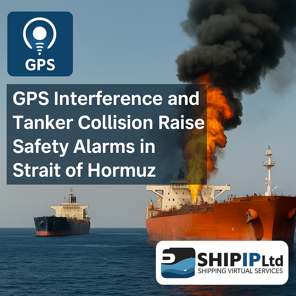
In the past 72 hours, multiple vessels in the Strait of Hormuz have reported severe GPS interference, resulting in erratic navigational behavior. This culminated in a serious incident involving the oil tanker Front Eagle, which collided with the vessel ADALYNN, leading to an onboard fire and minor spill.
The collision was reportedly linked to spoofed GPS signals that misled the Front Eagle’s navigational systems, causing a sudden course deviation. Emergency response units contained the fire, and all crew were evacuated safely. The collision and spill area have triggered an environmental monitoring operation.
🛰️ What Is GPS Spoofing?
GPS spoofing is the deliberate broadcast of false GPS signals, causing a vessel to believe it is in a different location than it truly is. This can result in:
-
Incorrect autopilot routing
-
Navigation into restricted waters
-
Increased collision risk
This interference has been confirmed by data from commercial satellite tracking and reported widely by global shipping operators.
🔒 Recommended Actions for Ship Operators
To safeguard vessels navigating the Persian Gulf, especially around the Strait of Hormuz, the following best practices are strongly advised:
1. Use Redundant Navigation Methods
-
Cross-check GPS with radar, visual bearings, and inertial navigation systems (INS)
-
Update crews on dead reckoning and manual plotting skills
2. Autopilot Safety Protocols
-
Disable autopilot in high-risk areas and steer manually
-
Increase bridge watch vigilance and apply voyage data recorder (VDR) reviews
3. Situational Awareness
-
Monitor NAVTEX, IMO GISIS, and UKMTO alerts for real-time guidance
-
Use AIS overlays and satellite services (like GNS Watch) to detect spoofing anomalies
4. Cybersecurity Drills
-
Simulate spoofing/jamming scenarios during bridge team drills
-
Test GPS signal validation via ECDIS-integrated tools where available
5. Report and Record
-
Immediately report GPS disruptions to UKMTO and MARLO Bahrain
-
Log incident time, false coordinates, and corrective actions in the vessel logbook
🌍 Broader Implications
The incident highlights a growing maritime cybersecurity and navigational safety threat in geopolitically sensitive regions. Shipping companies, charterers, and P&I clubs are closely monitoring risk levels, and rerouting is under consideration for some operators.
A formal investigation has been launched. The IMO is also reviewing the use of multi-layered navigation systems to prevent future spoofing-induced accidents.
📣 Stay Informed
SHIP IP encourages all ship operators and safety officers to update their navigational safety manuals and conduct crew refresher training in light of these developments.
For support or customized fleet guidance, contact us via:
📧 support@shipip.com | 🌐 www.shipip.com